A key outcome of this research project is to influence what and how we teach students in Planning, Geography, and First Nations Studies. Our teaching is grounded in the priorities of our community partners, as well as current discussions and interests among professional planners and policymakers.

Students conducting conservation field work at Walpole Island First Nation, courtesy of Micha Pazner.
Courses
This course is offered by Dr. Leela Viswanathan as a four-week intensive course for professional planning graduate students at Queen’s University, School of Urban and Regional Planning. The course was first offered in Winter 2015 and is being offered again in Fall 2016. The course is conducted in the classroom and the students greatly benefit from the involvement of First Nation partners and community members. Upon successful completion of the course, students are able to:
- develop general knowledge of governance, policy, and planning issues affecting First Nations in southern Ontario.
- critically reflect upon the diverse standpoints of individuals, organizations, and municipalities directly involved in shaping issues and processes in planning with First Nations.
- formulate their own opinions and justify connections between issues in land use planning and means by which planners and First Nations communities address these issues.
In Winter 2015, students were involved in small group projects involving revising the Ontario provincial Greenbelt Plan and specific municipal official plans from southern Ontario according to criteria identified by our First Nation community partners. All PWIP Research Group researchers and community partners were involved in teaching and mentoring the students.
In Fall 2016, students will benefit from a guest lecture by PWIP community partner, Carolyn King, about the Moccasin Identifier project and the impact of the Indian Act on First Nations in Ontario. Students will gain exposure to and reflect upon land use planning issues in Tyendinaga Mohawk Territory as conveyed by Lisa Maracle, Director of Community Services with the Mohawks of the Bay of Quinte – Tyendinaga Mohawk Territory. Policy analysis is central to this course and student groups will analyse municipal plans in South Eastern Ontario for their relevance to and inclusion of First Nations. Finally, students will consider how they, as individuals, and as future members of the planning profession may begin to respond to the Calls to Action of the Truth and Reconciliation Commission of Canada’s Final Report.
Professors Rick Fehr and Micha Pazner offered this field course for Geography and First Nations Studies students in Fall 2014 at Western University. The learning objectives of the field-course are designed to introduce students to the historic and contemporary realities experienced by Indigenous and non-Indigenous peoples on Walpole Island and the neighbouring community of Chatham-Kent.
The course exposes the students to complex social and environmental histories and situations, all with the goals of enhancing the students’ overall understanding of:
- the colonial basis of contemporary planning and policy-making;
- decolonization in the planning process;
- historical and contemporary interactions between people and diverse ecologies;
- the ways in which Indigenous and non-Indigenous peoples can work together toward common objectives.
An article reporting on the course outcomes to the Walpole Island First Nation community can be found here:
Some of the student responses in 2014-15 were:
"This is easily the best class I have ever taken. When you are immersed in your learning environment, and doing rather than hearing, you learn tenfold more. Learning in the classroom will never be the same..."
"Phenomenal course. Great, holistic, and reciprocal learning experience. Learned theoretical practical, and person lessons that will continue to affect me beyond the class."
"Could not think of a better learning experience then this community-based approach."

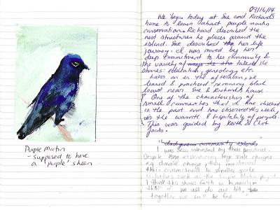
Student journal entry from field Course at Walpole Island, courtesy of Nandini Thogarapalli