|
|
PEARLPaleoecologicalEnvironmentalAssessment andResearchLaboratory |

|
|
|
PEARLPaleoecologicalEnvironmentalAssessment andResearchLaboratory |
|
|
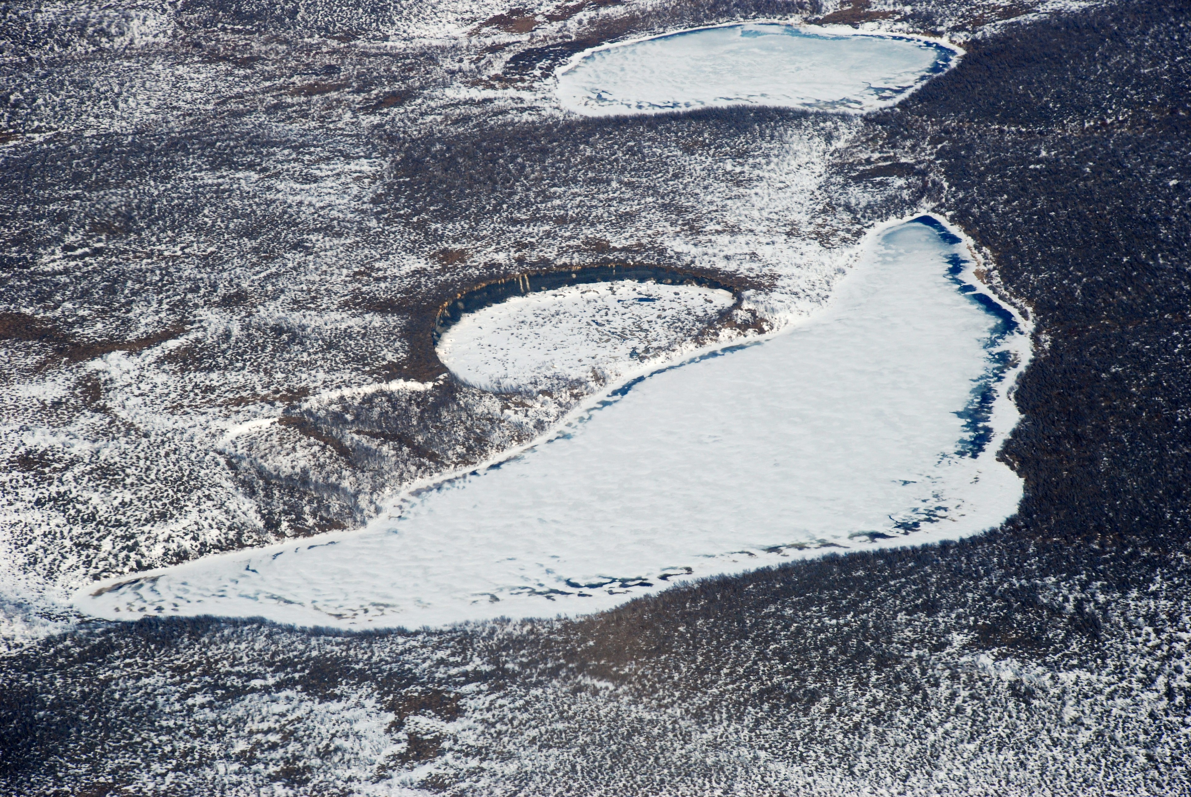
Core collection and sedimentary remains of indicator species |
|
|
|
|
|
Collecting a sediment core. The removal of a 7.6 cm (3") diameter sediment core from a lake in the Mackenzie Delta is carried out from a small raft, with the area accessed by helicopter. Image courtesy of Joshua Thienpont (Brock University). |
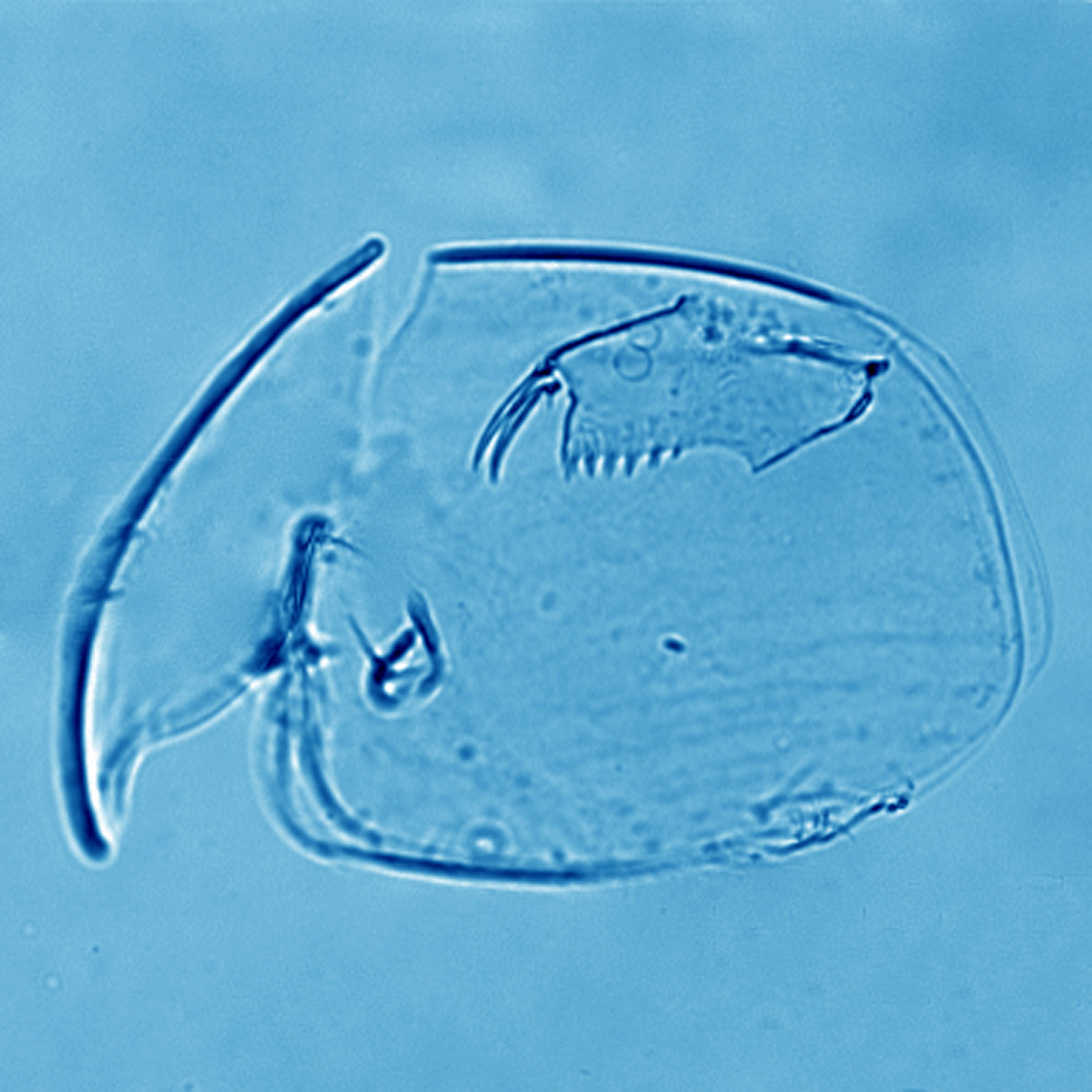
Alona sedimentary remains. Most body parts of the shallow water cladoceran species Alona are well preserved in lake sediments. Image courtesy of Jennifer Korosi (University of Ottawa). |
|
Examples of drilling mud sumps. Note: These are sumps and not the thaw slumps depicted further down. Check difference between sump and slump. Sumps marked by ↓ . |
||
 |
 |
 |
|
Drilling mud sump with significant ponding. This large drilling sump exhibits ponding both on the surface and perimeter. Image courtesy of Joshua Thienpont (Brock University). |
Drilling sump in close proximity to a lake. The drilling sump is located upslope of the small lake, and any materials leaching from the sump could potentially enter the lake. Image courtesy of Joshua Thienpont (Brock University). |
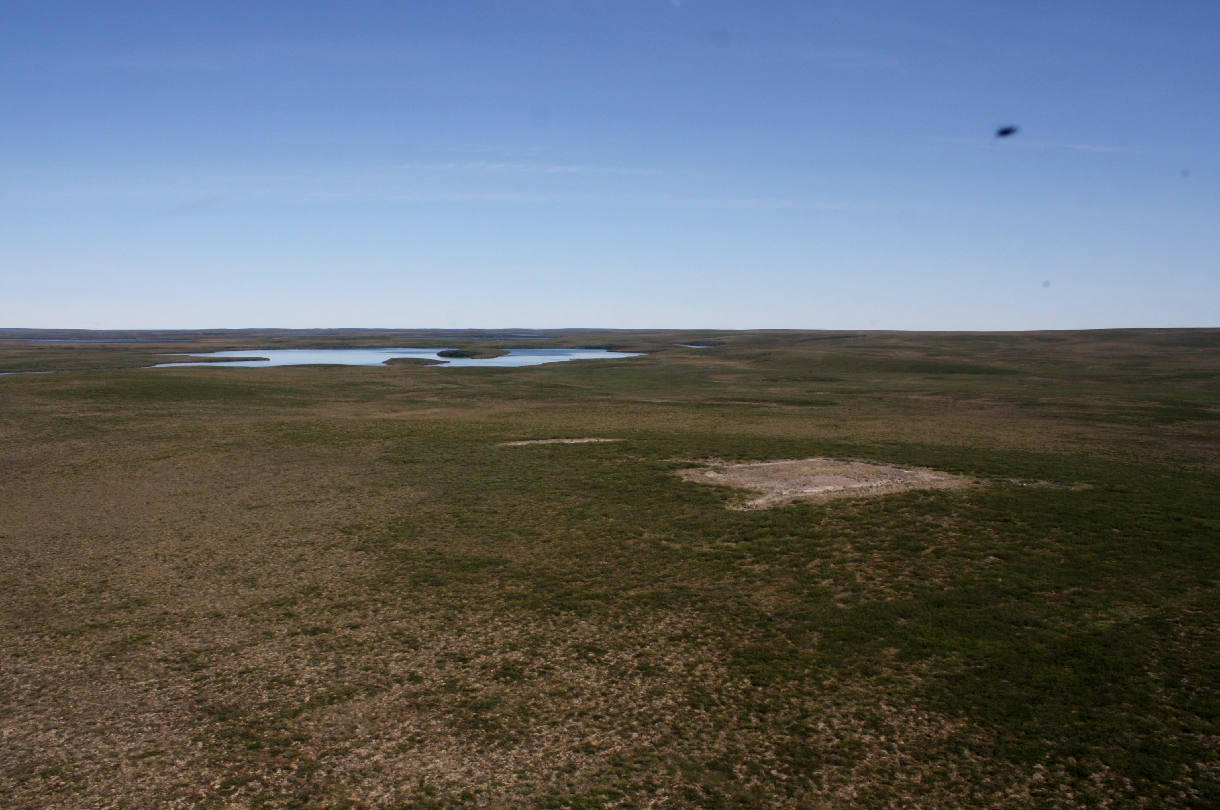
Large drilling sump near Mackenzie Delta lake. This large sump is perched above and close to the edge of a small lake. The gravel road created during drilling is still visible. Image courtesy of Joshua Thienpont (Brock University). |
 |
 |
|
|
Drilling mud sump near a small lake. Image courtesy of Steve Kokelj (Government of the Northwest Territories). |
Drilling mud sump in the Mackenzie Delta uplands showing surface ponding. Image courtesy of Steve Kokelj (Government of the Northwest Territories). |
Drilling mud sump. The large, raised cap of the drilling sump is noticeable because of its altered vegetation and ponding around the perimeter. Image courtesy of Joshua Thienpont (Brock University). |
 |
 |
 |
|
Drilling mud sump exhibiting significant surface and perimeter ponding. Image courtesy of Michael Pisaric (Brock University). |
Drilling mud sump exhibiting significant surface and perimeter ponding. Image courtesy of Michael Pisaric (Brock University). |
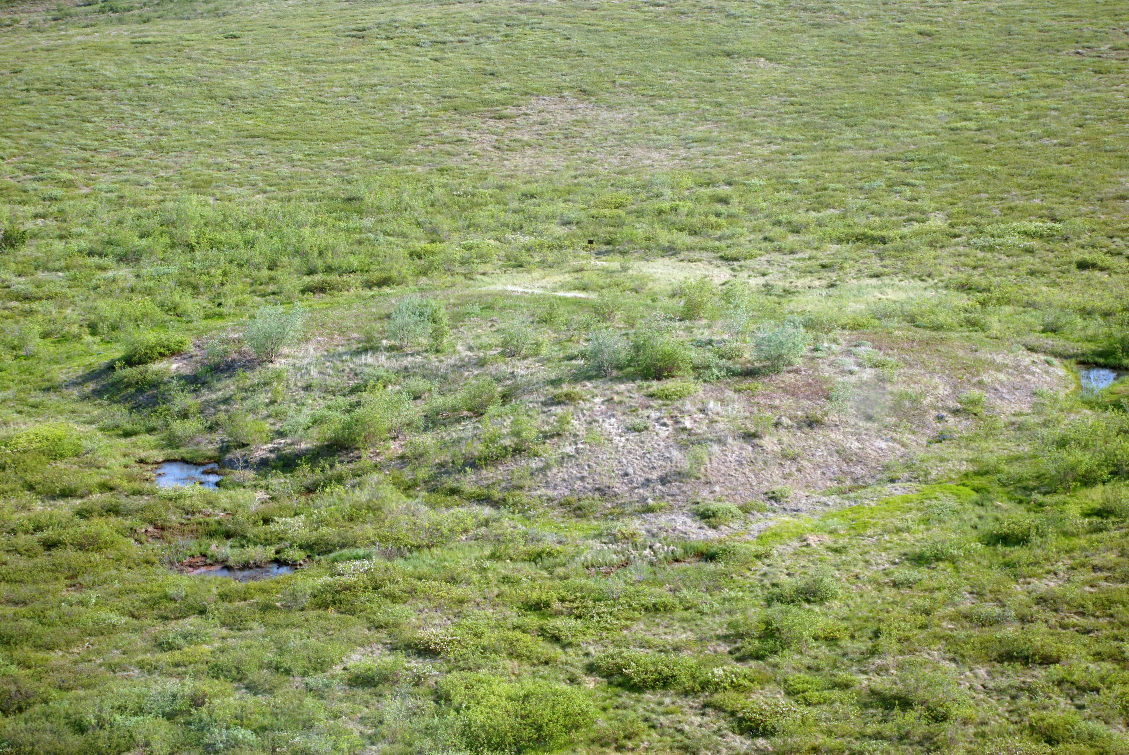
Drilling mud sump with an un-vegetated gravel cap. Image courtesy of Michael Pisaric (Brock University). |
 |
 |
 |
|
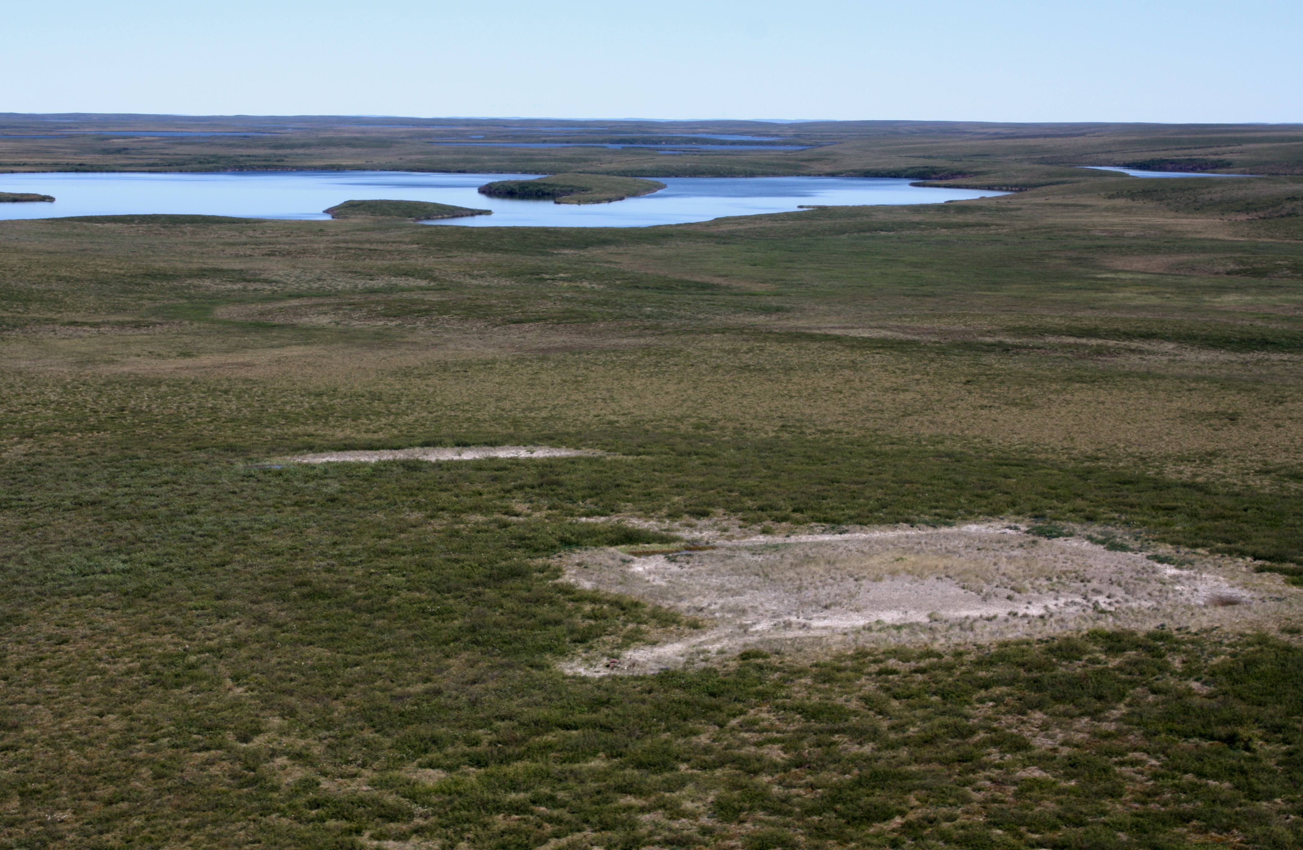
Drilling mud sump with a small lake in the background. Image courtesy of Michael Pisaric (Brock University). |
Drilling mud sump with an un-vegetated gravel cap. Image courtesy of Michael Pisaric (Brock University). |
Drilling mud sump with an un-vegetated gravel cap. Image courtesy of Michael Pisaric (Brock University). |
|
Examples of thaw slumps. These are not collapsing sumps, but examples of how rapidly and extensively permafrost is thawing in this region. |
||
 |
 |
|
| Lake with a large retrogressive thaw slump. Our study compared the water chemistry of lakes with drilling sumps to these highly-disturbed lakes. Image courtesy of Joshua Thienpont (Brock University). | Thaw slump headwall. The ice-rich headwall of an active retrogressive thaw slump in the Mackenzie Delta uplands region. Image courtesy of Steve Kokelj (Government of the Northwest Territories). | Lake with a large, active retrogressive thaw slump. Image courtesy of Steve Kokelj (Government of the Northwest Territories). |
 |
||
| Large, active retrogressive thaw slump. This spectacular form of permafrost degradation is common in the Mackenzie Delta uplands region. Image courtesy of Joshua Thienpont (Brock University). | ||
|
|