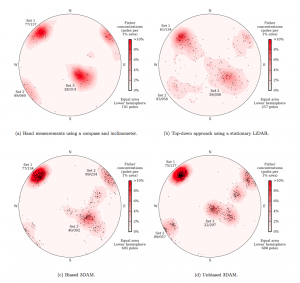
In the world of geotechnical engineering and geoscience, understanding the characteristics of rock masses is of critical importance. Many engineering projects (e.g., the construction of roads, buildings, bridges, tunnels, as well as both surface and underground mines) require interactions with rock masses, which have highly anisotropic properties due to the existence of discontinuities. These discontinuities usually manifest themselves as planar surfaces that come in sets (called joint sets), each statistically distributed in orientation. Mapping these sets, by making strike and dip measurements, is a fundamental task in geotechnical engineering.

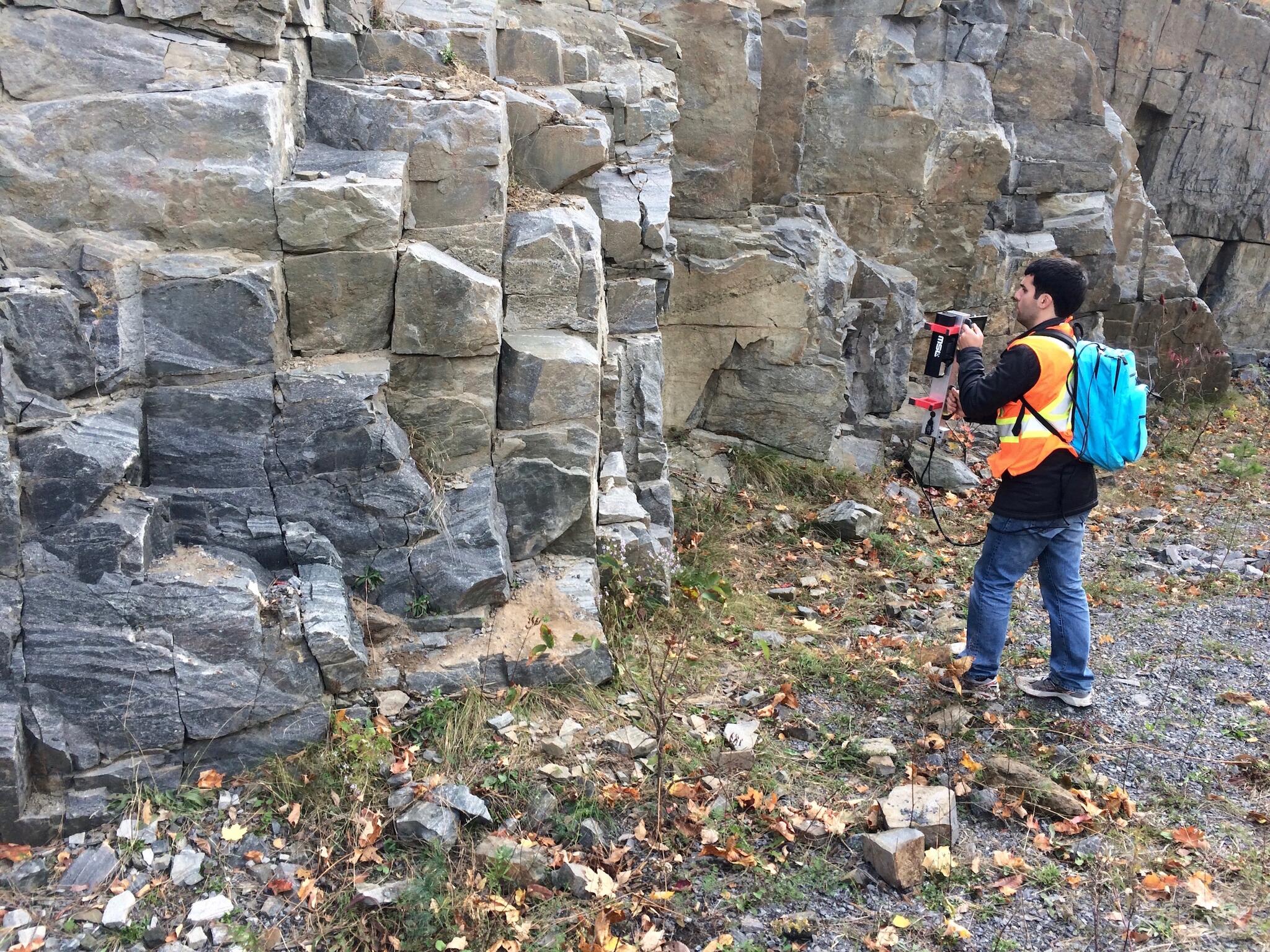
However, manually collecting strike and dip measurements with a Brunton compass is tedious and time consuming. And, in some cases, this task can be dangerous if you have to get close to unsupported and/or newly excavated rock. There are other, less developed, ways of doing this by using camera (photogrammetry) or stationary LiDAR measurements, but there can big problems with these methods, including price, accuracy, and the need for significant human input (and error). Hence, these approaches are not widely used in industry.

In this project, funded in part by the NCFRN, we developed a new approach called axis mappingthat provides a quick and easy way for geotechnical engineers or geologists to automatically generate rich and complete stereonets that map the joint sets of exposed rock cuts, whether these are on surface, underground, or in hard-to-reach places. Our system is lightweight, mobile, fast, and accurate.
In the spring of 2016, with the support of PARTEQ Innovations, MSL decided to give some entrepreneurial Queen’s students (via the QICSI program) the chance to exploit their newly developed intellectual property. A team of students took up the challenge and we are happy to report that they have formed the spin-off company RockMass Technologies.


Related Publications
M. J. Gallant and J. A. Marshall. Automated rapid mapping of joint orientations with mobile LiDAR. In the International Journal of Rock Mechanics and Mining Sciences, vol. 90, pp. 1-14, December 2016. DOI: 10.1016/j.ijrmms.2016.09.014
M. J. Gallant. Axis Mapping: The Estimation of Surface Orientations and its Applications in Vehicle Localization and Structural Geology. Ph. D. Thesis, Department of Electrical and Computer Engineering, Queen’s University, September 2016.
M. J. Gallant and J. A. Marshall. The LiDAR Compass: Extremely lightweight heading estimation with axis maps. In Robotics and Autonomous Systems, vol. 82, pp. 35-45, August 2016. DOI: 10.1016/j.robot.2016.04.005
M. J. Gallant and J. A. Marshall. Automated three-dimensional axis mapping with a mobile platform. In Proceedings of the 2016 IEEE International Conference on Robotics and Automation (ICRA), Stockholm, Sweden, May 2016. DOI: 10.1109/ICRA.2016.7487236
M. J. Gallant and J. A. Marshall. Two-dimensional axis mapping using LiDAR. In IEEE Transactions on Robotics, vol. 32, no. 1, pp. 150-160, January 2016. DOI: 10.1109/TRO.2015.2506162
M. J. Gallant, J. A. Marshall, and B. K. Lynch. Estimating the heading of a Husky mobile robot with a LiDAR compass based on direction maps. Invited paper in Proceedings of the 2014 International Conference on Intelligent Unmanned Systems, Montreal, QC, September 2014.
Project Support
This project was funded in part by the Natural Sciences & Engineering Research Council of Canada (NSERC) under project NETGP 417354 - 11.


